

Graig Syfyrddin [Edmund's Tump]
Good walks are even better shared.
SO4021 : Fence near the summit of Edmund's Tump
Philip Halling Photo source
Overview
Graig Syfyrddin [Edmund's Tump]
Overview
Graig Syfyrddin, affectionately known as Edmund's Tump, is nestled in the stunning Brecon Beacons National Park. At an elevation of 250 meters, this Marilyn may not be the tallest peak in the region, but it packs a punch in terms of scenery and charm.
Geology
This hill is primarily composed of Old Red Sandstone, which gives it a unique reddish colouration. This rock formation creates a rich ecology, with diverse flowering plants and intriguing geological features to marvel at during your hike.
Access and Transport
Accessing Graig Syfyrddin is straightforward. The nearest parking area is conveniently located along the A470, with a clear signpost marking the start of the Beacons Way trail that leads up the hill. If you're relying on public transport, Brecon has regular bus services that connect to different parts of the national park, albeit with variable schedules, so it's wise to check ahead.
Hiking Route
One popular route is the Beacons Way, which stretches about 6.5 km and takes roughly 2.5 hours to complete at a moderate pace. It's a delightful jaunt with lovely views, perfect for soaking in the natural beauty the Beacons have to offer.
Summit Features
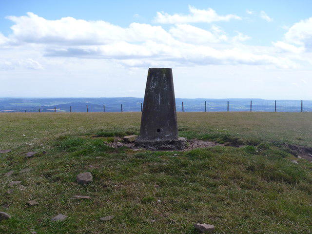
Reaching the summit, you'll be greeted by a sturdy trig point, used by surveyors long before GPS made us all reliant on smartphones. The area around this point often attracts curious sheep, adding an element of charm to your visit.
Terrain and Views
The terrain is a mix of grassy expanses and some rocky sections, so keep an eye on your footing—especially if the rain makes things slippery. Once you reach the top, you'll be treated to breathtaking views, including the majestic Black Mountains and the rolling hills stretching towards Somerset. The best seasons for these vistas are spring and autumn, when the landscape bursts with life and colour.
Hazards
While Graig Syfyrddin is accessible, hikers should remain cautious of rapidly changing weather conditions. Fog can roll in unexpectedly, making navigation tricky. Proper footwear is essential, especially after rain, as certain paths may become muddy.
Nearby Locations
If you're keen for more adventure, nearby summits such as Pen y Fan and Corn Du are just a stone's throw away, offering greater challenges and stunning panoramas.
Facilities
In Brecon, you'll find plenty of cafes and shops where you can refuel after your hike. Breakdown of facilities, including toilets, can often be found at the visitor centres around the park—always a welcome sight after a long trek!
Conclusion
Graig Syfyrddin may not boast the highest elevation, but it certainly offers an enriching outdoor experience ideal for families, seasoned hikers, and anyone in between. Don't forget your camera—those views won't capture themselves!
Happy hiking!
Explore routes near Graig Syfyrddin [Edmund's Tump]
Walks starting near this hill. Open a route to check its map, distance and full itinerary.
Clytha Estate: River Usk, Chapel Ruins and Castle Woods
View route
Goytre Wharf to Pentre Bridge: Mon and Brec Canal Walk
View route
Hereford Walk with Men Walking & Talking
View route
Forest of Dean Hicksters Way Woodland Circuit from Cannop
View route
Route planning notes
These notes describe possible approaches. Check a route's map and access information when planning your walk.
Beacons Way
A scenic trail traversing the Brecon Beacons, leading to the summit with stunning views along the way.
Make a day of it, together
Find someone to share the walk with, or organise a day out along a route you like.
Photo Gallery
View all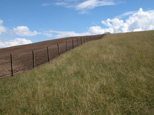 Photo could not load
SO4021 : Fence near the summit of Edmund's Tump
Philip Halling
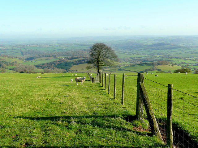 Photo could not load
SO4021 : View east from Edmund's Tump
Jonathan Billinger
![SO4021 : Around Edmund's Tump [1]](https://cdn.walkmates.com/gallery-images/b031933a63db493b8f797166145d326d.jpg) Photo could not load
Photo could not load
SO4021 : Around Edmund's Tump [1]
Michael Dibb
![SO4021 : Edmund's Tump [4]](https://cdn.walkmates.com/gallery-images/564a0bf9e3ba43ce9060eddd88aa88a4.jpg) Photo could not load
Photo could not load
SO4021 : Edmund's Tump [4]
Michael Dibb
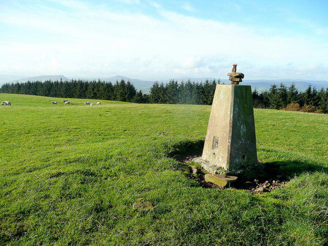 Photo could not load
SO4021 : Trig point on Edmund's Tump 1
Jonathan Billinger
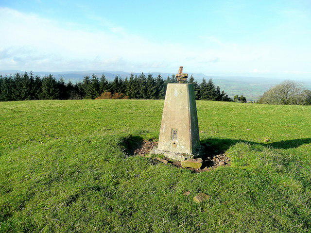 Photo could not load
SO4021 : Trig point on Edmund's Tump 2
Jonathan Billinger
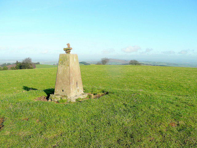 Photo could not load
SO4021 : Trig point on Edmund's Tump 3
Jonathan Billinger
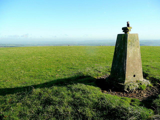 Photo could not load
SO4021 : Trig point on Edmund's Tump 4
Jonathan Billinger
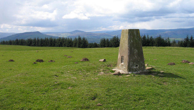 Photo could not load
SO4021 : Summit area of Graig Syfyrddin
Trevor Littlewood
SO4021 : Edmund's Tump [1]
Michael Dibb
Hill facts and local notes
Classifications
Elevation
423m
1,388 ft
Prominence
235m
Coordinates
51.8850, -2.8675
SO403210
OS Map
161
Explorer: 189
At the Summit
The summit features a prominent trig point, lovingly surrounded by heather and a few cheeky sheep eyeing the hikers with mild curiosity.
Terrain & Geology
Graig Syfyrddin is primarily composed of Old Red Sandstone, a durable rock known for its distinctive reddish hue, providing a beautiful contrast against the green landscapes.
Views & Scenery
Views of the Black Mountains, the rolling valleys of the Brecon Beacons, and on a clear day, even the Somerset Hills in the distance.
History & Heritage
Name Origin
The name 'Syfyrddin' translates to 'The Hill of the Syfyrddin', possibly referencing ancient legends tied to the area.
Historical Significance
The mountain is part of the historic and cultural landscape of the Brecon Beacons, an area steeped in folklore and breathtaking beauty.
Getting There & Facilities
Parking
There is a small parking area at the foot of the hill along the A470, marked by a signpost indicating the Beacons Way.
Public Transport
Regular bus services run from Brecon to various points in the area, but check schedules as they vary throughout the year.
Nearby Facilities
Cafes, toilets, and shops in Brecon. Frequently used facilities can be found at the visitor centres in the Brecon Beacons National Park.
Safety Information
Known Hazards
- Unpredictable weather conditions, especially fog that can roll in quickly. Navigating in wet weather can be slippery, so sturdy footwear is advised.
General Safety Tips
- Check weather conditions before setting out
- Carry appropriate clothing and equipment
- Let someone know your planned route
- Take a map, compass, and GPS device
- Carry emergency supplies: food, water, first aid kit, torch
Hills
Some common questions about the hills answered
Are there group walks up Graig Syfyrddin [Edmund's Tump]?
Many walkers use Walkmates to join or organise walks with others. You can check for group walks around Graig Syfyrddin [Edmund's Tump] through the maps
Are there other walkers around Graig Syfyrddin [Edmund's Tump]?
Activity varies by location and time, but Walkmates lets you see whether others have shared walks or shown interest in this area. Find other people through the walking friends search walking friends for Graig Syfyrddin [Edmund's Tump] search or of course create your own walk for Graig Syfyrddin [Edmund's Tump]
Can I organise a walk to Graig Syfyrddin [Edmund's Tump]?
Yes. If there aren’t any walks listed already, you can create a walk and make it available for others to join.
If you're signed up to Walkmates, you can create a walk to Graig Syfyrddin [Edmund's Tump].
How do I find a walk up this hill?
There are often multiple ways to walk this hill, depending on experience and route preference. Walkmates helps you explore walks and routes that others have shared.
Can I suggest a new route up Graig Syfyrddin [Edmund's Tump]?
Yes. You can suggest or create routes to share with others. Walkmates focuses on the social side of walking, so routes are used to help people organise walks and explore areas together, rather than as detailed navigation tools or route libraries.
Other uses really appreciate knowledgeable walkers sharing their routes. Share your favourite route to Graig Syfyrddin [Edmund's Tump] here
The is an error or something incorrect about this hill. How do I let you know?
We always strive to keep the information on Walkmates as accurate as possible. If you find an error, please let us know through the contact form and we'll aim to correct it as quickly as possible
Community Discussion
Comments
Location
![Graig Syfyrddin [Edmund's Tump] location map](https://cdn.walkmates.com/hill-maps/hill-sources/2272/51.88496_-2.86747.png)
Grid reference: SO403210
View on OpenStreetMapOpens a map in a new tab, centred on the hill.

No comments yet. Be the first.